News Summary
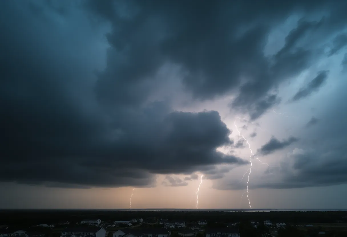
Residents in South Carolina, particularly in the Myrtle Beach area, are facing severe thunderstorm alerts. The National Weather Service has warned of strong thunderstorms with wind gusts reaching up to 40 mph, potential lightning, and hydroplaning risks on slick roads. The alert affects multiple counties, including Dillon, Florence, and more. Staying indoors and taking safety precautions is highly recommended as the storms develop throughout the morning.
Severe Thunderstorm Alerts Hit South Carolina: What You Need to Know
Good morning, South Carolina! If you’re in the Myrtle Beach area or any of the nearby counties, you might want to grab a cozy spot inside because thunderstorm alerts are swirling around and bringing potential havoc your way. As an updated report from the National Weather Service (NWS) Wilmington NC hit at 1:46 a.m. on Friday, strong thunderstorms are ramping up until 2:45 a.m. This situation does have the potential for some seriously gusty winds and lightning, making it a perfect time to stay alert and know what’s going on.
Where Is It Hitting?
This alert covers multiple areas including Myrtle Beach, Inland Georgetown, Coastal Georgetown, Conway, Dillon, Florence, Marion, and Williamsburg counties, just to name a few. To add a bit of detail, if you’re located in Rhems, Blue Brick, Stuckey, Cades, or any of the following towns – Johnsonville, Nesmith, and even near the Williamsburg Regional Hospital – you are directly in the path of these storms!
What to Expect
So, what can you expect from these thunderstorms? Well, forecasters are predicting wind gusts of up to 40 mph. Yikes! This gusty wind has the potential to knock down tree limbs and scatter those unsecured objects lying around outside. Think lawn chairs and garden decorations that could easily become projectiles if left unanchored.
Stay Safe Inside
The NWS highly recommends that if you are outdoors during this alert, it’s best to *seek shelter inside a proper building.* Remember, lightning strikes the US approximately 25 million times each year, with summer being the peak season for such activity. In fact, annually, there are about 20 fatalities due to lightning, so it’s definitely something to take seriously.
Hydroplaning Risks
Another important aspect to be wary of during heavy rainfall is hydroplaning. This occurs when a vehicle slides uncontrollably on a wet road due to the water buildup in front of the tire. Hydroplaning can lead to loss of vehicle control and can be particularly dangerous during storms. Make sure to drive cautiously and keep your distance on those slick, rainy roads!
Other Areas of Concern
Over in McCormick County, an alert was issued at 9:03 p.m., indicating that windy conditions of up to 50 mph are expected, along with nickel-sized hail, which measures around 0.88 inches. Those living near Lake Strom Thurmond and Hickory Knob State Resort Park should be particularly cautious, as gusty winds can lead to minor damage to outdoor objects.
Be Prepared
Stay safe out there, South Carolina! Your safety is the top priority as we weather these storms together!
Deeper Dive: News & Info About This Topic
HERE Resources
Severe Weather Causes Havoc Across Middle Tennessee
Severe Thunderstorm Watch Issued for Tennessee Valley and Indiana
Central US Faces Severe Weather and Flooding Risks
Myrtle Beach Faces Thunderstorms While Florence Welcomes Publix
Massive Storm System Threatens Over 100 Million Americans
Severe Weather Alert: A Weekend of Storms Ahead!
Severe Weather Alert for South Carolina: Strong Storms Approaching
Winter Weather Alert: Two Major Storms Expected
Much-Needed Rain Set to Hit Southern California
A Polar Vortex is Set to Affect Much of the U.S.
Additional Resources
- Myrtle Beach Online: Severe Weather Update
- Weather.com: Myrtle Beach Weather
- Myrtle Beach Online: Thunderstorm Alerts
- Google Search: Severe Thunderstorm Alerts South Carolina
- The State: Weather News
- Wikipedia: Thunderstorm